Fine Art Photography
_24A8061-Edit.jpg

Blog

David J Grenier Fine Art Photography Blog Pages

Posts in Blog
So Far, So Good! First Half of 2017

I have been very fortunate to photograph in a number of beautiful locations during the first half of 2017. This has probably been my most rewarding six months of photography in the first half of any year, and therefore want to briefly memorialize these experiences in this blog post. I will go through each location and pick a few images that I think highlight the best moments of the time spent there.

Yosemite Valley, California

At the top of the list is Yosemite National Park, which I have visited five times so far this year. My first visit was January 5th, and my last was May 10th. During those times, I also conducted two private workshops with special clients that I enjoyed spending time with showing the nooks and crannies of one of my most favorite places on earth. The highlight for this blog though has to be the massive rains that California received this year, and the resultant flooding that occurred in Yosemite Valley. California had been in a six year drought until this year, where the drought formally came to an end due to massive rain and snowfalls, with this season going into the history books as the second wettest in 122 years of record-keeping!

iPhone 7 Plus; 5:05 pm, February 10, 2017

The image above was shot on the evening of February 10th when I first arrived and began to drive around the Valley. In all the years I have been visiting Yosemite I have never seen standing water in this particular location, or that much of it. It is also interesting to note the sign that shows the level of the water in this location on January 2, 1997, the last big flood in the area. The flood stands as arguably the park's worst natural disaster to date (some would give this designation to the rockfall of 1996 or the Rim Fire of 2013), and inarguably the worst flood in park history. The flooding stranded 2,100 visitors in the park, albeit fortunately there were no fatalities. Total park damages were estimated at $178 million at that time.

Canon EOS 5DS R; 1/40 sec at f/11; Canon EF 16-35mm @ 16mm; ISO 100; 8:57 am, February 11, 2017

I began thinking about a reflection shot immediately I saw this standing water and came back the next morning at sunrise. I have never seen a shot like this showing Upper and Lower Yosemite Falls reflected from this particular location previously, so was very excited to capture this unique image. The small rainbow at the base of Upper Yosemite Falls was a nice added touch.

Canon EOS 5DS R; 1/25 sec at f/16; Canon EF 16-35mm @ 16mm; ISO 125; 9:09 am, May 11, 2017

This reflection shot of El Capitan and the Three Brothers was shot three months later to the day, when warmer weather created a powerful snow melt that caused the Merced River to overflow its banks in some places that, again, I had never seen standing water. I got my lower body very wet getting this shot, a three image panorama, standing in water that was a few inches deeper that the tops of my Wellingtons that got completely filled with very cold water! All's well that ends well:)

Canon EOS 5DS R; 0.6 sec at f/18; Canon EF 24-105mm @ 32mm; ISO 125; 6:30 pm, May 11, 2017

I thought that I would leave you with this sunset shot from Cook's Meadow, with the beautiful infamous elm tree in the foreground, fondly referred to as 'Ansel's Tree'. It is interesting how the weather patterns can change so rapidly in Yosemite. When we set up at this location, it did not look like there was going to be much of a sunset this particular evening. There was a small cloud sitting at the top of Half Dome and at best we were hoping for some alpine glow on the granite face. Gradually that cloud morphed into this beautiful structure that then began to catch color from the setting sun

Monument Valley/Hunts Mesa, Arizona

I had wanted to photograph Monument Valley, Arizona, for sometime now, and when I found an Arizona Highways Photo Workshop that would take me to Monument Valley, as well as Hunts Mesa I decided to sign up immediately. Along with a good friend, we began our journey to Arizona on May 26, and returning May 30, including visits to Kayenta, Monument Valley, and the highlight of the trip being an overnight camping stop in the incomparable Hunts Mesa.

Monument Valley, a red-sand desert region on the Arizona-Utah border, is known for the towering sandstone buttes of Monument Valley Navajo Tribal Park. The park, frequently a filming location for Western movies, is accessed by the looping, 17-mile Valley Drive. The famous, steeply sloped Mittens buttes can be viewed from the road or from overlooks such as John Ford’s Point. Hunts Mesa forms the southeastern edge of Monument Valley and the northern edge of Little Capitan Valley. Its elevation is 6,370 feet (1,942 m). Access to Hunts Mesa is not through the general entrance of the park but rather through the sand dunes northeast of the town of Kayenta, Arizona.

Canon EOS 5DS R; 121 sec at f/11; Canon EF 16-35mm @ 18mm; ISO 160; 9:09 am, May 11, 2017

I chose the shot above of Monument Valley, at sunrise, where I decided to use my 10 stop filter to accentuate the clouds in the sky with a two minute long exposure. It created the streaks in the clouds and gave it an interesting, unique look that added an element of drama to the scene, that includes the infamous East and West Mittens, together with the Merrick Butte on the right.

Canon EOS 5DS R; 1/250 sec at f/16; Canon EF 24-105mm @ 35mm; ISO 400; 9:09 am, May 11, 2017

This is a sunrise shot from Hunts Mesa, after a sleepless night in a small tent and howling winds that did not let up all night long! The tent was so small I could not stretch out on the cot that we were provided with, and it had been thirty plus years since I had slept in a sleeping bag. Clearly, this confirmed that it is illegal, as well as foolish for me to consider camping even for one night again:)

Canon EOS 5DS R; 1/6 sec at f/16; Canon EF 24-105mm @ 28mm; ISO 125; 9:09 am, May 11, 2017

This is the Totem Pole at dawn, and on the left the Yel-Bichel pinnacles. The Totem Pole is a pillar or rock spire and is a highly eroded remains of a butte. It is over 400 feet tall, and was last climbed by Clint Eastwood and George Kennedy in Eastwood’s 1975 film, The Eiger Sanction. The Yei-Bi-Chei pinnacles are named for their resemblance to the real dancers who appear on the ninth and last night of the Navajo winter religious ceremony called “The Night Way”.

Canon EOS 5DS R; 1/125 sec at f/11; Canon EF 24-105mm @ 65mm; ISO 200; 9:16 am, April 30, 2017

Monument Valley, has been featured in many forms of media since the 1930s. It is perhaps most famous for its use in many John Ford films, including Stagecoach (1939) and The Searchers (1956). It has also been featured in the film Easy Rider (1969), Robert Zemeckis' film Forrest Gump, Clint Eastwood's film The Eiger Sanction (1975), and recently the popular United Kingdom television show Doctor Who in the two episodes "The Impossible Astronaut" and "Day of the Moon". This is John Ford Point, named in honor of the movie director who spent a lot of time in Monument Valley, aside from making five movies here. We had a young Navajo Native American ride the horse in this image and pose as a model that provided an added interesting, and appropriate touch to the composition.

I would like to make a mention here of the leader of our workshop, a Navajo Native American photographer of renown, LeRoy DeJolie. This is the third Arizona Highways Photo Workshop I have taken with LeRoy, and I highly recommend him as a workshop leader. His local knowledge is second to none, works very hard to help any photographer that asks, and he is the perfect Navajo guide, a mandated necessity, to get us into these beautiful ancient Navajo lands. These workshops are a very reasonable cost method of getting to locations that you want to photograph, always led by a great professional photographer, who know the right places to go and at the right times of day, together with very competent support people who work very hard to make these events memorable.

Palouse, Washington

For my next photo shoot, I joined two of my closest photographer friends on a road trip that took us to the Palouse, Washington, onto Yellowstone National Park, and finally to the Grand Teton National Park, both in Wyoming.

The Palouse is the most serene and pastoral region in southeastern Washington characterized by gentle rolling hills covered with wheat fields. The hills were formed over tens of thousands of years from wind blown dust and silt, called "loess", from dry regions to the south west. Seen from the summit of 3,612 foot high Steptoe Butte, they look like giant, colored sand dunes because they were formed in much the same way. In the spring they are lush shades of green when the wheat and barley are young, and in the summer they are dry shades of brown when the crops are ready for harvest. The Palouse hills are not only a landscape unique in the world, but they are beautiful to behold and or photograph.

This was one of the most joyful shoots that I have ever experienced. The area to photograph is endless, the compositions are unlimited, and the lighting we had, both at sunset and sunrise was simply stunning. I have so many images that I like it is very difficult to choose, but I chose the following and hope that it portrays the region well and shows the endless beauty of this magnificent region of Washington state.

Canon EOS 5DS R; 1/125 sec at f/11; Canon EF 28-300mm @ 105mm; ISO 400; 5:49 am, May 23, 2017

This first image is a panorama that I shot during the first sunrise that we did from Steptoe Butte. This location, in my humble opinion, is what makes the Palouse so photogenic. It is the highest point in the region, and at the very top, it gives a photographer a 360 degree view to shoot from. The early morning light on these 'earth dunes' is magical, and the compositions are endless. The sunsets too are special, again because of the light and never ending views.

Canon EOS 5DS R; 1/4 sec at f/9; Canon EF 28-300mm @ 60mm; ISO 100; 8:16 pm, May 22, 2017

This is an image from our first sunset shoot on Steptoe Butte. The setting sun and the lupin created this beautiful scene typical of this magical area in Washington. The 3,612-foot (1,101 m) butte is preserved as Steptoe Butte State Park, a publicly owned 150-acre (61 ha) recreation area located 12 miles (19 km) east of the nearest town, Colfax.

Canon EOS 5DS R; 1/640 sec at f/11; Canon EF 28-300mm @ 80mm; ISO 500; 4:20 pm, May 24, 2017

This is a location that we stumbled upon driving up and down roads using a map of the region provided to tourists by the Pullman Chamber of Commerce. What made this location so special on this afternoon was the way the clouds in the sky filtered the light on the landscape, where as you waited the light changed and lit up different areas just like spotlights. Again so many compositions and three to four points of view to shoot from just one location.

Canon EOS 5DS R; 1/8 sec at f/11; Canon EF 28-300mm @ 28mm; ISO 400; 8:37 pm, May 24, 2017

After shooting the location above we drove around for quite some time looking for a location to shoot the sunset. With the ever present clouds in the sky we were anticipating a colorful sunset but had great difficulty finding a suitable location until we stumbled upon this hill, at what turned out to be on an unmarked private property. Soon after we decided that this location would have to do because we were running out of time before the sunset would begin, the farm owner drove up to inform us that we were on his private property.

With our best smile and diplomatic attitude we asked him if that meant we had to leave, and also informed him that if we had seen any signs driving in that told us we were on private property we certainly would not have done so. He was kind enough to let us stay, even though he did come back later after the sunset was over and saw us drive off his property. A wonderful end to an extremely productive day!

Yellowstone National Park, Wyoming

Yellowstone National Park is a nearly 3,500-sq.-mile wilderness recreation area atop a volcanic hot spot. Mostly in Wyoming, the park spreads into parts of Montana and Idaho too. Yellowstone features dramatic canyons, alpine rivers, lush forests, hot springs and gushing geysers, including its most famous, Old Faithful. It's also home to hundreds of animal species, including bears, wolves, bison, elk and antelope. The Yellowstone Caldera is a volcanic caldera and supervolcano located underground in Yellowstone, sometimes referred to as the Yellowstone Supervolcano.

The term “supervolcano” implies an eruption of magnitude 8 on the Volcano Explosivity Index, indicating an eruption of more than 1,000 cubic kilometers (250 cubic miles) of magma. Yellowstone has had at least three such eruptions: The three eruptions, 2.1 million years ago, 1.2 million years ago and 640,000 years ago, were about 6,000, 700 and 2,500 times larger than the May 18, 1980 eruption of Mt. St. Helens in Washington State.

While the Yellowstone national park in Wyoming is stunningly beautiful, with brightly coloured sulphuric hot springs and erupting geysers, it packs a mighty punch. If the volcano were to erupt, it could cause a global catastrophe, particularly in the US where it would instantly kill 87,000 people and make two-thirds of the country immediately uninhabitable as the large spew of ash into the atmosphere would block out sunlight and directly affect life beneath it. I can only hope that this does event not need to occur in all of its majesty during my lifetime!

Canon EOS 5DS R; 1/10 sec at f/11; Canon EF 16-35mm @ 16mm; ISO 160; 5:59 am, May 26, 2017

The Grand Prismatic Spring, discovered by geologists in 1871, is the largest hot spring in America and the third largest in the world. It has a diameter of about 295 feet and a depth of 164 feet. In the center of the spring the water is so hot that the bacteria is not able to survive, whereas the temperature gradually drops towards the edges. This explains why the dazzling bright yellows, fierce oranges and deep reds only appear around the edges while the deep blue remains confined to the center. It is located in the Midway Geyser Basin and is one of my favorite geyser springs to photograph in Yellowstone.

One item of interest that we learned while we were at the Yellowstone Visitor Center, is that the Park Rangers have been in the process of constructing a viewing platform on on the ridge that you see in the background of the image above. It is scheduled to open in July this year, and will provide a magnificent photographic opportunity to capture the whole of this spring from above, something that has only been previously available to adventurous people who were willing to climb up into the hills around this area. Can't wait to get there again and photograph from the new location!

Canon EOS 5DS R; 1/5 sec at f/14; Canon EF 16-35mm @ 27mm; ISO 125; 5:52 am, May 28, 2017

Silex Spring, a favorite go to sunrise location when in Yellowstone, has a temperature of 193 F and is 36 feet x 40 feet, and a depth of 27 feet. It is unknown when or by whom this colorful blue spring was named, but the name Silex may refer to the word silica. Some believe it may refer to the Silex coffee percolator. The spring boils occasionally and, periodically large bubbles of gas rise to the surface. The 1959 earthquake caused it to erupt and increased the flow. The discharge is now 70 to 100 gallons per minute.

Canon EOS 5DS R; 1/25 sec at f/11; Canon EF 24-105mm @ 28mm; ISO 125; 2:15 pm, May 27, 2017

This is Lower Yellowstone Falls, and an area of the Park that I had not visited the last time I was here in the fall last year. Yellowstone Falls consist of two major waterfalls on the Yellowstone River. As the Yellowstone river flows north from Yellowstone Lake, it leaves the Hayden Valley and plunges first over Upper Yellowstone Falls and then a quarter mile (400 m) downstream over Lower Yellowstone Falls, at which point it then enters the Grand Canyon of Yellowstone, which is up to 1,000 feet (304 m) deep.

Canon EOS 5DS R; 1/500 sec at f/5.6; Canon EF 1oo-400mm @ 100mm; ISO 800; 9:21 am, May 28, 2017

On our final day in Yellowstone we set out to photograph Bison. Not exactly my expertise so I wanted to get some practice in and bring back one or two images of these majestic animals. This was our first stop, where I managed to get this beautiful animal as it just crossed the Madison River, near West Yellowstone. The male Bison can weigh approximately 2000 lbs., and this one still had on its winter coat, albeit soaking wet in the rear because it had just swam across the river.

Grand Teton National Park

Grand Teton National Park is in the northwest of the state of Wyoming. It encompasses the Teton mountain range, the 4,000-meter Grand Teton peak, and the valley known as Jackson Hole. It’s a popular destination in summer for mountaineering, hiking, backcountry camping and fishing, linked to nearby Yellowstone National Park by the John D. Rockefeller, Jr. Memorial Parkway. It is only 10 miles (16 km) south of Yellowstone National Park. Grand Teton National Park is named for Grand Teton, the tallest mountain in the Teton Range. This is a beautiful location to stop at on your way into Yellowstone or on your way out. I first visited it last year in the fall and wanted to see it in the spring, which did not disappoint one bit! From my experience in this area I have found that there are four classic locations for photography, and I have images from each one below.

Canon EOS 5DS R; 1/4 sec at f/16; Canon EF 24-105mm @ 82mm; ISO 100; 5:18 am, May 29, 2017

Sunrise at the T.A. Moulton Barn and with the Grand Teton showing in the background. The T. A. Moulton Barn is all that remains of the homestead built by Thomas Alma Moulton and his sons between about 1912 and 1945. It sits west of the road known as Mormon Row, in an area called Antelope Flats. The property with the barn was one of the last parcels sold to the National Park Service by the Moulton family.

Canon EOS 5DS R; 1/15 sec at f/11; Canon EF 24-105mm @ 50mm; ISO 800; 4:45 am, May 30, 2017

Oxbow Bend in Grand Teton National Park is located just a little over a mile straight east of the Jackson Lake Junction on Highway 89.  It's where the Snake River gets extremely wide and Mount Moran is seen reflecting in the calm water in all it's glory.  It's really a sight to behold. Oxbow Bend is without a doubt the most photographed place in the entire park.  The image of the Snake River with Mount Moran's reflection is iconic and is probably the most recognized image of Grand Teton National Park throughout the world.  It is a magnificent sunrise location, and it is grand central station in the fall, where I have seen over 300 plus photographers line up for a sunrise shoot!

Canon EOS 5DS R; 1/13 sec at f/11; Canon EF 24-105mm @ 32mm; ISO 125o; 4:57 am, May 31, 2017

Schwabachers Landing is a boat landing located a few miles south of Snake River Overlook, along the east shore of the Snake River. It provides an opportunity for beautiful reflections of the Grand Teton range, and is especially beautiful in low morning light at sunrise. Having the duck in the foreground was a bonus, and in order to ensure it was sharp I adjusted my ISO to 1250. One huge noticeable difference shooting in these locations in the spring vs the fall, is in spring there were a significantly less number of photographers to contend with in all of these locations.

Some 75 years ago you could see the bend of the Snake River, where Ansel Adams included it in one of his most iconic images in 1942, The Tetons and the Snake River. Today the trees have grown, as you can see in the image below, and you can no longer see that bend in the river, though it is still one of my favorite places to see and photograph the Grand Teton Range.

Canon EOS 5D Mark III; 1/25 sec at f/16; Canon EF 24-105mm @ 40mm; ISO 10o; 4:37 pm, May 30, 2017

On the last evening of our stay in the Park, we decided that we would go out and practice photographing Bison again. That is until, driving out of Jackson we noticed a massive and beautiful storm sitting right above the Teton Range. We immediately decided that we should head straight out to the Snake River Outlook, an ideal location to photograph this gnarly looking storm. I was so excited to have this opportunity as I had never seen such a beautiful looking sky over this mountain range and was so looking forward to the chance to capture some unique images.

We literarily raced out to the location, got out of the vehicle, opened the trunk to reach for my camera and tripod when it hit me - I had left both my camera bodies in my hotel room. I was incredulous that I could have made such a stupid mistake! We had been photographing Bison earlier in the day, and I had long lenses on both camera bodies which gave me a wider choice of focal range. When we got back to our hotel earlier in the day, I grabbed both bodies and headed up to the room to change lenses and set everything back to the way it normally was. I then forgot to bring them back out with me to the vehicle when we left.

The owner of the vehicle we were traveling in very kindly offered his vehicle for me to drive back and fetch my camera, which I did in about 45 minutes, and by the time I got back there was still a beautiful sky available and I ended up with some nice images after all. You get by with a little help from your friends:)

San Francisco

Canon EOS 5DS R; 1/120 sec at f/9; Canon EF 24-105mm @ 50mm; ISO 1000; 7:40 pm, June 24, 2017

And finally, I will leave you with an image of Mt. Tamalpais that I shot last Sunday. I took a very good friend and photographer with me to show her this phenomenon of coastal fog that rolls in and creates beautiful scenes as it washes over into the Marin Headlands in the summer. We went back to a spot that my daughter Michelle, who lives in the area, took me to just over two years ago. We had a lot more fog on that particular day, though this experience did not disappoint!

As I wrap up this blog post just before the celebration of this country's Independence Day, I feel grateful and excited about the photographic opportunities that I have had so far this year. I also feel grateful to have some wonderful friends to accompany me on these photo journeys, whose presence makes these adventures even more fun. I am now getting ready to leave on my first professional assignment for a marketing company in San Francisco. I am being sent out to the beautiful island of Kauai, Hawaii, on the 4th of July returning July 13th, to shoot landscape images on what is so rightfully called the 'Garden Isle'.

The adventure continues!

Outdoor Photographer Magazine, Photo of the Day, 6-1-2017

I just arrived home today, June 1, 2017, from a photo shoot that took me to the Palouse region in Washington, then on to Yellowstone National Park, with our final stop being the Grand Tetons National Park. It was a photo shoot that has provided me with hundreds of images to sort through and develop, a difficult and time consuming task as I have so many that I like,  so choosing which ones to work on is difficult. A good problem to have:)

Going online to get caught up with all I needed to check on, I discovered that one of my images from a Patagonia shoot late last year had been selected by the Staff of 'Outdoor Photographer Magazine' as the Photo Of the Day, June 1, 2017. This indeed is an honor and a thrill as OPM is the premier landscape magazine in the USA. It also made me happy because this is my favorite image from the Patagonia trip. Here is the link to their online post: https://www.outdoorphotographer.com/photo-day-david-grenier/?platform=hootsuite

In all the time we spent in Patagonia, both Argentina and Chile, we had very strong winds blow. While these are the prevailing winds in the region, as a photographer a goal of this trip was to capture reflection shots of the magnificent local mountain ranges - Mt. Fitzroy in Argentina and Paine Massif, located in Torres del Paine National Park, Chile.

On this particular morning, while I knew the chances were low, I wanted to walk to a lake located at the bottom of these beautiful distinctive three granite peaks of the Paine mountain range or, Paine Massif. With two other photographers in tow, we set out to walk to the lake. It was a long walk, begun in the dark and we kept walking until day light first appeared.  After a lengthy walk it became obvious that there was no still water anywhere. We reached the lake, confirmed that there was no reflection shot and began walking back.

The next composition I was contemplating in my mind was the early morning light that I knew was about to hit these granite peaks. In the foreground I also knew that I had to use the omnipresent dead, silver colored trees, still standing from accidental fires that ravaged the park at various times going back to 1985. I captured another image before this one, did not like the composition and quickly scrambled into a place that I could also include the path. Back at the hotel later that day I developed this image and was very happy with how it turned out!

Photo Of The Day By David Grenier

By Staff | May 31, 2017 |

Today’s Photo Of The Day is “Patagonia Morning Light” by David Grenier. Location: Torres del Paine National Park, Chile.

Photo By David Grenier

Today’s Photo Of The Day is “Patagonia Morning Light” by David Grenier. Location: Torres del Paine National Park, Chile.

“One of my favorite images from a Patagonia trip last November, shot at sunrise on a cloudy morning with the magnificent and distinctive three granite peaks of the Paine mountain range or Paine Massif,” says Grenier. “Torres del Paine National Park encompasses numerous mountains, glaciers, lakes, and rivers in southern Chilean Patagonia. In the foreground are the omnipresent dead, silver-colored trees, still standing from accidental fires that ravaged the park at various times going back to 1985.”

Photo of the Day is chosen from various OP galleries, including AssignmentsGalleries and the OP Contests. Assignments have weekly winners that are featured on the OP website homepage, FacebookTwitter and Instagram. To get your photos in the running, all you have to do is submit them.

2016 Top Twelve Photographs of the Year

“Twelve significant photographs in any one year is a good crop.”~ Ansel Adams

It is that time of the year again for me to share with you my 2016 Top Twelve Photographs of the Year. This is the 4th edition of this tradition that began in 2013, that was inspired by Ansel Adam's quote shown above. Ansel Easton Adams (February 20, 1902 – April 22, 1984), is one of the most recognizable names in American landscape photography. His black-and-white landscape photographs of the American West, especially Yosemite National Park, have been widely reproduced on calendars, posters, books and prints. He is revered by landscape photographers all over the world, and to this day continues to have and operate The Ansel Adams Gallery in Yosemite National Park http://anseladams.com/

When you shoot a few thousand images, as I do on an annual basis, it is difficult to cull it all down to 'twelve significant photographs' so, as in previous years, I determine my Top Twelve, and the order of the selections, by looking back at my Facebook page and noting how many 'Likes' I received when they were originally posted on my wall. I am fully aware that this is far from scientific and could be argued that it is downright arbitrary, but that is the method I have used and arbitrarily choose to continue to do that again this year:)

I was fortunate to have traveled and created opportunities to shoot in a wide variety of places in 2016. From my favorite venues such as Yosemite National Park, Mono Lake, Bodie Historical State Park, and the Central Coast in California, this year I was also able to shoot for the first time along the Pacific North West Coastline in Oregon. There were a number of other memorable firsts for me this year ~ The Grand Teton's National Park, Yellowstone National Park, and last but not least and a highlight of the year was a visit to the Patagonia regions of Argentina and Chile. It was also my first visit to the Continent of South America, and adds to my list of Continents that I have already visited - Asia, Australia, Africa, Europe and North America. That makes it 6 of the generally recognized 7 Continents, with the outstanding 7th now being Antartica. I wish I could tell you that I have in an interest in making it to all 7, but I have no interest as of this writing to do so since cold weather to this day chills me to the bone!

So again this year I will count them down starting with Number 12, give you the Facebook vote count, say something about each image, and provide some basic EXIF data.

#12 (112) 'In the Footsteps' ~ Some fall colors in the foreground and the Grand Tetons basked in afternoon light, shot from the Snake River Landing parking lot in the Grand Tetons National Park, Wyoming. This was the location that Ansel Adams shot one of his iconic black and white images, perhaps one of his most famous, entitled The Tetons and the Snake River, in 1942. Back then the Snake River bend created a beautiful leading line into the Tetons, where as now those trees have grown upwards a great deal and the shot is quite different, but still beautiful, especially with the fall colors. Adams was passionate about the natural landscape in which he spent much of his childhood, and would use his art to convince, or remind, others of it's beauty. Still a worthwhile pursuit for any photographer even today!

IMG_7328-Edit-700x467.jpg

Sep. 17, 2016, Snake River Landing, Grand Tetons National Park, WY; exp. 1/125 sec @ f/11; 24-105 mm lens at 60 mm; ISO 100

#11 (115) 'Light My Fire' ~ This is what is commonly known as the 'Horsetail Falls phenomenon'. What you see in the image below is Horsetail Falls light up by the setting suns' light shining on the water that flows down this particular location for a few weeks in February in Yosemite National Park. It is one of nature’s most wondrous sites to watch how this phenomenon gradually develops high on top of the eastern side of El Capitan, where I am certain thousands of people drive by and do not even know that this waterfall exists! For this amazing site to occur, water needs to be present in the falls, the sunset needs to unobstructed by clouds in the western sky, which then lights up the falls and its spray to look like it's on fire within the last few minutes of the setting sun. I have had the good fortune of being here three times over the last many years to view and photograph it, and this last time was simply the best!

IMG_3901-Edit-600x900.jpg

Feb. 16, 2016, Yosemite National Park, CA; exp. 0.5 sec @ f/11; 70-200 mm lens+1.4x at 257 mm; ISO 100

#10 (116) 'Lady in Red'~ Alpenglow at sunset reflected in the Merced River, at Valley View, or also know as Gates of the Valley, Yosemite National Park, California. El Capitan (Spanish for The Captain) is located on the north side of Yosemite Valley, near its western end, the granite monolith extends about 3,000 feet (900 m) from base to summit along its tallest face and is one of the world's favorite challenges for rock climbers and BASE jumpers. Along with most of the other rock formations of Yosemite Valley, El Capitan was carved by glacial action. This is one of my favorite locations to shoot at sunset when the skies are completely devoid of clouds, and the alpenglow can be counted upon to give a photographer this beautiful reflection photographic opportunity!

MG_1185-Edit-Edit-Edit-600x900.jpg

Nov. 14, 2016, Valley View, Yosemite National Park, CA; exp. 2.5 sec @ f/11; 24-105 mm lens at 28 mm; ISO 100

#9 (120) 'Tranquil Solitude' ~ I have shot this lone oak tree from this particular location, a ten minute drive from my home, so often that it has now unofficially been named My Oak Tree! Over the years I have been fortunate to shoot many an image here, always blessed with amazing skies that light up at sunset. This particular image shows a typical winter's evening in Northern California, a place I have called home now for almost 14 years, when the hills begin to turn green again, a chill is in the air, and we are blessed with these beautiful skies. I love this spot because it allows me to be creative between photo shoots to exotic, far away locations, and enjoy this pastoral scene a few minutes from the hustle and bustle of city life. I also don't take if for granted that one day this location will become a massive construction site for the continuous urban sprawl that we have become accustomed to and put it down as 'the progress of man'!

MG_1315-Edit-Edit-Edit-Edit-700x467.jpg

Dec. 4, 2016, El Dorado Hills, CA; exp. 3.2 sec @ f/11; 24-105 mm lens at 40 mm; ISO 100

#8 (122) ‘Homeward Bound’“The fact that we live at the bottom of a deep gravity well, on the surface of a gas covered planet going around a nuclear fireball 90 million miles away and think this to be normal is obviously some indication of how skewed our perspective tends to be.” – Douglas AdamsIt had been a desire of mine for several years to capture the Milky Way arch, and I finally did so at South Tufa, Mono Lake, June 2, 2016! For a technical point of view, this is 7 different images taken with my camera on a tripod, beginning at the left side of the Milky Way and then rotating the camera and shooting another image several times. I then 'merge' the resultant 7 images in a function of Adobe Photoshop, creating a final image that looks like the one below. Some fun facts about The Milky Way - the Galaxy measures some 100,000–120,000 light-years in diameter, it is home to planet Earth, the birthplace of our humanity. Our Solar System resides roughly 27,000 light-years away from the Galactic Center (far right). The Milky Way has between 100-400 billion stars; but when you look up into the night sky, the most you can see from any one point on the globe is about 2,500, which on a new moon night and the accompanying dark skies, and a mere mortal like me looks up at the sky, I would swear that I was looking at all 400 billion stars in the galaxy! It is overwhelming, humbling and I strongly recommend that you experience this at least once in your lifetime!

IMG_5780-Edit-Edit-Edit-Edit-2-700x403.jpg

June 2, 2016, Mono Lake, CA; exp. 3o sec @ f/2.8; 16-35 mm lens at 19 mm; ISO 6,400

#7 (138) 'Shine On You Crazy Diamond ~ Closed out 2016 with this image, shot during a couple of days that I spent with my son in the Big Sur area mid-December. This is Keyhole Arch, Pfeiffer Beach, Big Sur, California, and the phenomenon that occurs annually during the time of the Winter Solstice. The best light for this happens mid-December to mid-January, when the setting sun shines through the Keyhole, provided there is a cloudless sky on the western horizon at sunset. I always find this to be such a fun shoot. You must arrive early as the parking lot at Pfeiffer Beach, privately managed, is small and fills up quickly. The beach is crowded with lots of families and photographers. It is not difficult to get a spot to shoot from as most photographers move around as the setting sun moves around and gives you different looks as it pours in through the Keyhole. I leave you with this thought for the New Year ~ ‘We must accept finite disappointment, but never lose infinite hope.’ ~ Martin Luther King, Jr.

MG_1882-Edit-Edit-Edit-Edit-2-700x467.jpg

Dec. 19, 2016, Keyhole Arch, Pfeiffer Beach, Big Sur, CA; exp. 1/6 sec @ f/11; 24-105 mm lens at 60 mm; ISO 100

#6 (144) ‘Mountain Light’ ~ One of my favorite images from the Patagonia trip, shot at sunrise on a cloudy morning, with the magnificent, and distinctive three granite peaks of the Paine mountain range or Paine Massif. The Torre del Paine National Park, encompasses numerous mountains, glaciers, lakes, and rivers in southern Chilean Patagonia. In the foreground are the omnipresent dead, silver colored trees, still standing from accidental fires that ravaged the park at various times going back to 1985. To me this was one of the highlights of our Patagonia photo shoot, as the scenery and the views of this magnificent mountain range on this particular morning was simply spectacular. The early morning light was special and the hundreds upon hundreds of dead, silver colored, gnarly trees added a great deal to the setting, providing ample foreground material to make any composition interesting.

MG_0775-Edit-2-Edit-Edit-700x467.jpg

Oct. 31, 2016, Torre del Paine National Park, Chile; exp. 1/8 sec @ f/11; 24-105 mm lens at 28 mm; ISO 160

#5 (150) 'Touching' ~ I set off to capture the supermoon at Yosemite National Park, set to rise on November 14, 2016. The moon’s orbit around Earth is slightly elliptical so sometimes it is closer and sometimes it’s farther away. When the moon is full as it makes its closest pass to Earth it is known as a supermoon. At perigee — the point at which the moon is closest to Earth — the moon can be as much as 14 percent closer to Earth than at apogee, when the moon is farthest from our planet. The full moon appears that much larger in diameter and because it is larger shines 30 percent more moonlight onto the Earth. Due to some miscalculations that I made as to the time and precise location of the moonrise, I was unable to capture that particular event much to my disappointment. However, the next morning, quite frankly by accident more than precise planning, I was got to photograph the setting full moon. I was able to get into a position where I had the moon setting upon these burnt pine trees, which was an interesting juxtaposition of the moon sitting on top of the charred remains of the tree trunks. It was a beautiful sight to see, one that will not be visible again this close to Earth until November 25, 2034. Fairly good chance most of us will be long gone by then:)

MG_1202-Edit-Edit-Edit-Edit-700x467.jpg

Nov. 15, 2016, Yosemite National Park, CA; exp. 1/400 sec @ f/11; 400 mm lens+2x at 800 mm; ISO 200

#4 (182) 'Stuck in the Middle' ~ The waterfalls, streams and rivers in and around Yosemite Valley typically have an abundance of water flowing in spring time, a result of the winter's snow beginning to melt and the run off begins. It is a wonderful time of the year to visit Yosemite. This is an image that I shot, precariously hanging off the edge of the bridge over Cascade Creek in early March. The lone tree growing, seemingly out the middle of these two rocks caught my eye, and I wanted to capture the chaos of the raging waters around the stillness of the rocks, with the lone, bare tree stuck n the middle. I tried a number of camera setting and settled for this one, trying to freeze the movement of the water and show a sense of the turbulence and power of the rushing water juxtaposed against the stillness that these two rocks provide with the lone tree growing in the middle of this natures chaos.

IMG_4451-Edit-Edit-Edit-600x900.jpg

Mar. 8, 2016, Cascade Creek, Yosemite NP, CA; exp. 0.3 sec @ f/11; 70-200 mm lens at 91 mm; ISO 100

#3 (258) 'Peaceful Easy Feeling' ~ This is one of my favorite locations to visit, just hangout, and photograph in Yosemite National Park. It has many names - River Bend, Housekeeping Bend, as well as Camp 4. It provides a wonderful view of the magnificent Half Dome, with many different faces, colors and features dictated by what happens in the various seasons in Yosemite. This was shot February 18, a day after a snow storm swept thorough the area, when I was in the Valley intent on shooting the Horsetail Falls phenomenon that can occurs about this time every year. The title of this image derives from what I feel every time I stand at this location in Yosemite National Park, with the Merced River in the foreground and the magnificent Half Dome in the background. I have many a fond memory of this location in just about every season, and always look forward to visiting it every time I am fortunate to be in the Park.

IMG_4103-Edit-2-Edit-Edit-600x900.jpg

Feb. 18, 2016, Yosemite NP, CA; exp. 2 sec @ f/2; 16-35 mm lens at 17 mm; ISO 50

#2 (261) 'Perfectly Still' ~ This is one of my favorite images from my trip to Patagonia in the latter part of the year. I had never been anywhere before in South America, but always wanted to visit the Patagonia region, that encompasses parts of Argentina, as well as Chile. This was shot in Torre del Paine, Chile, with the Cuernos del Paine and Almirante Nieto mounts reflected in Lake Pehoé at sunset. Patagonia is famous for its prevailing winds, so strong that a gust can knock you down to the ground and often. That is not conducive to reflections, to say the least. So two quotes come to mind about this image - ‘Creativity is intelligence having fun’ ~ Albert Einstein, and ‘You don’t take a photograph, you make it’ ~ Ansel Adams. It took an unusual effort for me to make this image, but I also had a lot of fun doing so!

MG_0717-Edit-Edit-Edit-Edit-700x457.jpg

Oct. 29, 2016, Torre del Paine, Chile; exp. 2.0 sec @ f/11; 24-105 mm lens at 40 mm; ISO 50

#1 (323) 'Both Sides, Now' ~ The early spring months in Yosemite National Park are a great time to photograph reflections in the Valley. It is a time before the snow that accumulates during the winter months begins to melt and eventually begins rushing down the various waterfalls that end up in the Merced River. This image was captured the day after a small  snow storm passed through Yosemite, creating these beautiful clouds around the dawn wall of this iconic land marks in the Valley. I shot this from one of my favorite locations to view the magnificent El Capitan, and its reflection in a very still Merced River (with the aid of a polarizer). I dedicated this to one of my all time favorite singer songwriters, Joni Mitchell, who is recovering from a brain aneurism suffered early last year. Get well Joni, your songs are very much a soundtrack of my youth, wishing you a full and speedy recovery!

IMG_4128-Edit-2-600x900.jpg

Feb. 18, 2016, Yosemite NP, CA; exp. 1.3 sec @ f/22; 16-35 mm lens at 16 mm; ISO 50

And there you have it, my fourth annual Top 12 Photographs for the 2016 year. Also, a continuing tradition, a few observations in closing - 1. Six of the Top Twelve images voted on in 2016 were shot in Yosemite National Park (a first), my own Granite Cathedral, where I go to converse with God:), 2. nine of the twelve were shot in California, (another first), 3. two were from Patagonia, Chile, 4. the remaining one of the twelve was shot in Wyoming, and 5. five of the images were vertical compositions (another first). It is interesting for me to compile these images every year and be reminded of the wonderful accomplishment I was privileged to be allowed to complete by traveling to these beautiful locations, as well as what excellent tastes that the followers of my Facebook page have, and how much these people help in my selection process at the end of each year. So a big thank you to all these people for taking the time to do so - greatly appreciated!

In conclusion, and as always, I owe a great deal of gratitude to the many people who support my photography by purchasing my images in print form, as well as the hundreds of Likes and Comments that so many people take the time to stop by and leave on my Facebook page at http://facebook.com/djgrenier Last but not least, the wonderful and talented photographers and friends of mine that I travel and live with during these photographic journeys through out the year - again, my deepest thanks!

Looking forward to 2017 and wishing everybody a Wonderful New Year!

The Face 2016 Annual Photo Contest

I decided to enter The Face 2016 Annual Photo Contest. I entered 3 images. They were all selected to the Semi-Finalist round. They all made it to the Finalist round. One of them was selected to be Honorable Mention. I was pleased to say the least, and pledge to do more street portraits in 2017, an activity that I have only attempted less than a handful of times in the last 10 years! Thank you to the Editors/Judges at Digital Photo Pro magazine.

The Face Photo Contest Winners

First Prize Marta Everest

Carolina

I took this indoor portrait of my daughter in our living room with the help of a single softbox and a light-colored background. To keep it simple, I only used a piece of cream-colored fabric and a pretty floral tie for her hair. She did the rest.

Equipment/Settings: Nikon D810, 50mm/ƒ/1.8/1/320s/ISO 250


Second Prize Bhasker Koppula

Portrait Of A Stranger

This photograph was taken on a lazy Sunday afternoon in Salt Lake City in Downtown Utah. I was out with one of my friends, and the mission was to do street photography. When we came across this gentleman, who was a homeless person, I knew he’d be a perfect subject for a close-up portrait photograph. We asked if he’d be okay with being photographed, and he obliged. We took a few photographs in the ambient sunlight without any additional lighting source of any kind. I tried to focus on his eyes as I thought they were very expressive.

Equipment/Settings: Nikon D800, 24-70 mm ƒ/2.8 lens at 60mm. Shutter speed: 1/250 sec. ISO: 200, Aperture Priority mode. Adobe Photoshop.


Third Prize William King

The Profile

This photographic composite image focuses on illustrative portraiture. I began to formulate and digitally capture profile portraiture with model Chris Lavish in the studio. Lavish has highly stylized hair and a tattooed body, requiring additional attention by hair and make-up stylist Dilenia Peralta. My goal was to expand the digital creative process in multiple directions while complimenting and presenting the subject. I was able to re-orchestrate the color hue and saturation of textured background imagery, employed as a photographic background. An additional layer included a soft drop shadow behind the subject.

Studio lighting is so important to portraiture. In this project, my approach was to simplify the use of studio lighting. A seamless white background employed with no lighting on it produced a light grey background. Using one Profoto B2 head, with a Profoto 1×3-inch OCF Softbox, the single light was placed approximately 45 degrees behind the subject’s profile, facing two silver reflectors in front of the subject that reflected the light, wrapping it across the subject’s face and providing a gradational fill right to left. The light, though beautiful, amplifies the pores and requires considerable retouching in post.

The studio digital captures were made with a Nikon D800 using a Sigma 18-105mm ƒ/4 lens. Setting: ISO 100, 58mm focal length, exposure ƒ/11 at 1/160 of a second. The Profoto Air Remote TTL-N for Nikon was employed to provide wireless sink and exposure control.

Using Photoshop CC 2015, I first duplicated the background image, made a mask for the subject, and added a layer-style drop shadow, resized it then softened the shadow. I selected a textured image that I duplicated, and manipulated its color hue and saturation, texture, then resized it to complement the subject. Nik Color Efex Pro 4 was used to employ a skylight filter providing a warming effect to the background. I then created a new layer titled “Retouch” used to retouch the subject’s face and hair.

Honorable Mention David J Grenier

Are You Experienced

I had gone back to the country of my birth, Sri Lanka, for the first time after a 55-year absence. I was thrilled to be back and found I had a strong kinship with the local people that I had grown up with, having gone to school there and speaking the language for 15 years. I felt comfortable asking people their permission to photograph them and enjoyed the experience doing so. We had just visited the Dambulla Cave Temple, the largest and best-preserved cave temple complex in Sri Lanka, and walked to our bus to drive back to our hotel, when I spotted this man sitting on the side of the road.

He was one of many beggars that are commonplace in these parts, and his face caught my attention. He seemed as if he had gone through lots of experiences in his life, and I had a certain empathy for him and his plight, especially at this late stage of his life. I asked his permission to photograph him, but he spoke no English, but managed to get him to understand simply using hand gestures. In response to him saying yes, he also made it clear to me that he wanted some money in exchange, which I clearly intended to give him, regardless. I really enjoyed the expression in his eyes in this shot, which says, “I may be down and out, but I am still alive and grateful.”

Equipment/Settings: Canon EOS 5D Mark III; Exposure 1/125 sec @ f/ 4.0; Lens Canon EF 24-105mm f/4L IS USM; Focal length 67mm; ISO 160


Honorable Mention Gerardo Ramirez

The Editor

The objective behind my portraits is to reveal my subject’s personality, to allow them to tell their story with a gesture. As a video editor, my job is to tell a story using images and sound, which has helped me in my approach as a still photographer.

I like to capture genuine, unguarded moments rather than focusing on posing, so I treat my sessions as interviews, easing the person into telling me about them, or simply telling me a story.

The subjects in this series of photographs are people that I work with, and having that relationship with them allowed me to get to a point where they could behave in a way that shows their individuality. Each photograph in the series  is named with their actual work titles. The idea was to show who they are beyond that title, but at the end, I discovered their portraits revealed the way they approach their work.

Equipment/Settings: The photos were taken in a studio with a black background using a collapsible ring flash diffuser soft box. I used two cameras. I used a Nikon D7000 for “The Editor.” For all of them I used a Nikkor 24mm 2.8 lens and a Yongnuo YN560-II speed light. All the pictures were processed in Adobe Lightroom. Exposure 1/250 second ƒ/22, ISO 100, YN560-II 1/16 Zoom at 24mm.

Finalists

My other two entries that were included as Finalists.

To see a complete list of all 2016 The Face Finalists, visit http://www.digitalphotopro.com/photo-contests/the-face/


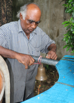
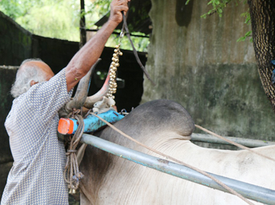
Sri Lankan Bullock Cart, and The Rest of the Story........

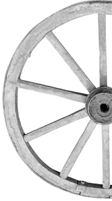
I visited the home of my birth Sri Lanka, for the first time after a fifty five plus year absence in 2014. It was a remarkable and memorable trip in many, many ways, and allowed me to come back to my home in California with a wonderful and varied collection of images. The image below, is of a bullock cart carrying a drum of kerosene that we happened to spot in our final days in Colombo, the city of my birth and the last place I lived with my family prior to immigrating to Australia in 1958. A shot of a bullock cart, a typical and memorable sight of my childhood, was one of my goals when I arrived back in the country.  A bullock cart is a two-wheeled or four-wheeled vehicle pulled by oxen (bullocks). It is a means of transportation used since ancient times in Sri Lanka, as well as many parts of the third world. They are still used today where modern vehicles are too expensive or the infrastructure does not favor them, especially for carrying goods, traditionally agrarian and lumber. The cart is attached to a bullock (or team) by a special chain attached to yokes, but a rope may also be used for one or two animals. The driver and any other passengers sit on the front of the cart, while the load is placed in the back.

During our twenty one day tour of the island we had not seen a bullock cart until this day, which made me hurriedly get out of the tour bus and try and get myself in a position to capture an image before it began moving again. I was able to include a few omnipresent tuk tuks, an automated rickshaw, which is clearly the most popular mode of transportation by the local Sinhalese and Tamil populations (arguably next to the bicycle). I was happy to have finally found and captured the image, but I do remember wondering about what it must be like to ride this rig everyday, specially being exposed to the putrid smells of the road - the diesel fumes from big buses and cargo carrying lorries and trucks, not to mention the flatulence from the bullock just ahead of you as the driver!

IMG_5020-Edit

This blog was written after all this time, surreptitiously indeed, when my cousin Michael (who was with me when this photograph was taken) forwarded to me a link to an article that was just published in the Sunday Observer, Sri Lanka's largest circulation English newspaper. Coincidentally, this is the same newspaper that published several articles written by my father J.A.R. Grenier in the 1950s. I was stunned when I first read the article to find out that this bullock cart is the only one of its kind in Colombo, and indeed the same one that we had found and photographed a little over two years ago. Gave new meaning to 'it's a small world'!

It is a heartfelt and informative story about the owner of this bullock cart and business, Mr. A. Chandana, and the trials and tribulations of his livelihood who has been doing this for "about 55 years". I do not want to be a spoiler of the story that I have included below that I encourage you to read completely, but Mr. Chandana says "I manage to scrape up about 1,200 - 1,500 rupees a day.” That translates to about US$8-10 per day, which I spend every time I go to the movies! He goes on to say "My needs, the bullocks needs, the household needs, the children’s needs - everything is taken care of with this money.”

This story and the plight of this man and his family brings to mind vivid memories of growing up in this magical island, and the stark and austere lives of the local people who struggle to eek out a living, yet who seem to be blessed with an unusual and upbeat disposition uncommon in the West, where our daily lives seem to be 'burdened with interruptions to our local WiFi or problems with our 200 TV channels of infotainment'. I am left feeling humbled with a new found gratitude for all that I have in my daily life!

And now, please read the Rest of the Story............

http://archives.sundayobserver.lk/2016/05/22/spe-cit-01.asp


The Last of the Bullock Carts

Sunday, May 22, 2016 (© 2016 Sunday Observer All Rights Reserved)

Are Colombo’s fuel-carting bovines on their last legs?

On a wet morning one Wednesday, we happened upon a wizened old man trundling past the Independence Square on a rickety, blue, bullock cart; A. Chandana claims he is the last of a species: A kerosene-vendor who uses a container pulled by a single Ox to transport his fuel around the city.

There was a time, recalls Marini, a long-time resident of Jaya Road, Bambalapitiya,that the ‘bullock-uncle’ - as we would call him, would come faithfully to the house with his ‘karaththey’ (cart) every day. “We were school children, so we didn’t know very much about what he did or why he was there, but I do remember sneaking up to the bull, with my siblings, and trying to make friends with him.”

Ashamed

Ann, a resident of Colpetty, remembers the same things: “Born and bred in the heart of Colombo, I am ashamed to say we didn’t know very much about what these men did, or why they were home,” she said. “But in a very British-brought-up-on-Enid-Blyton-fashion, we tried to feed the bullock sugar ‘cubes’ (virtually impossible to find!), and entice it with fruit!”

“I don’t remember the last time I saw one, though,” she said. “Anyway, they are from a time gone by”.

It is against this backdrop that Chandana makes his unhurried appearance. Dressed in faded shorts, a checquered shirt and with a hat pulled down firmly on his head, Chandana chews his betel slowly, taking time to think, before he speaks.

“About 55 years now,” he says in response to the question – ‘how many years in the business?’ Chandana says he began playing his cart in 1964. “At that time, a gallon of kerosene oil was 76 cents,” he said. “Now it is about Rs. 55 a litre.”

Discount

Born in Colpetty, A. Chandana is now a resident of Maradana, Colombo 10. He begins his work early: “I get my fuel from the ‘shed’,” he said.

“No, I don’t get a discount – I get for the same amount that other people get it for.”

“But, he added, “I sell it for about 5 rupees more: ‘Mey kakulata genath dena dey, ney’ (Its what I bring, almost up to their feet, no) “But still, it’s less expensive to buy from me than to but from the ‘kadey’ (local street shop). That is why they wait for me,” he said, of his customers.

“When they hear my bell, they all congregate on the street,” he said, with just the hint of a smile. “They depend on me. I go even to those tiny streets you can barely take a vehicle down,” – referring to the temporary dwellings that mark parts of Colombo.

So what exactly, does Chandana sell? “Kerosene oil,” he says. “But after gas came in, business has been bad.”

Research indicates that cooking fuels become cleaner, more convenient, efficient and costly as people move up the ‘energy ladder’ from animal dung, the lowest in the ladder, towards crop-residues, wood, charcoal, kerosene, gas and electricity…”

In Colombo - Gas and Electricity are increasingly dominant with fewer and fewer residents using wood or kerosene.

This is the reason why, Chandana is the last of a kind in Colombo: “Outstation, and in the outskirts of Colombo, there are people like me,” he said. “But I am the last one in Colombo.”

Maximum

Chandana says he has developed two ‘lines’. One of these routes takes him to Kirulapone, Bambalapitiya and Wellawatte, while the other takes him to “Magazine Road, Vaanathey and Obeysekarapura.”

“I work for four to five hours a day at maximum,” he said, “and I manage to scrape up about 1,200 - 1,500 rupees a day.”

“It’s with that money that we do everything we have to do.”

“I have a family,” he explained. “They are maintained with this money. My needs, the bullocks needs, the household needs, the children’s needs - everything is taken care of with this money.”

He admits the money is not enough. Especially with the advent of gas: “Before gas came along, I would sell about 4 carts of fuel,” he said. “Each cart load contains about 570 litres. Now, I am lucky if sell about 250-300 litres a day.”

He says it is unlikely he will do any other work. “Meka thama puruddata gihin thiyenney,” he says - “This is the job I am accustomed to. I can’t do anything other than this. I am now 64 years old. I have done this job from the time I was small.”

Business

“There were problems before,” he said, lapsing into memory. “We were not allowed on the streets till after 9 am – that affected business. But now, aparadey kiyanna beha, there are no problems with the ralahamis (policemen). There was a time I was mugged also - twice!”

“They threw chilli powder in my face and made off with 300 rupees, one time, I remember - 300 rupees was a lot of money in those days.”

“Now I don’t have that kind of problem anymore. Now the problems are the traffic, the heat, the rain – those things, but even that is not really a problem,” he said translucently.

“I wish I had another bullock or two, though,” he added, in sudden afterthought. “I could give this fellow a break then, and ride them alternately.” But a bull costs between 125,000 - 150,000 rupees, Chandana said, not something he can afford at the moment.

“I have another cart that I give for weddings. I earn something from that work. It’s a nice cart. But I use this same animal - if something happens to him, well, then I don’t know,” he said, shrugging.

The bullock, Chandana says, is housed at a ‘madama’ nearby. “I give it ‘poonakku’ in the morning. Then in the afternoon, after our rounds, I cut him a big bundle of grass and leave it there for him. He eats that until night.”

“Every so often someone will offer to buy my bullock,” Chandana said. “Sometimes people do that to set the bullock free. I use the money they give me to buy another bullock. I have changed bullocks like this, over 500 times in my life. But I never sell them to be slaughtered. We don’t even eat beef,” he said.

He says he is well received, wherever he goes: “People know me. On the streets they wave and say “Hello, Chandrey-Uncle!” or ‘Chandre’. Sometimes will even give me a Rs. 50 or Rs.100 ‘santhosam’ Some will make me a cup of tea, some will even give me food,” he said of the goodwill he generates.

“ I want to continue in this business,” he said. “I am used to this. I work 365 days a year. But I don’t know what will happen in the future.”

“Anyway, this trade will end with me,” he says with final, quiet conviction. “It’s true, I have a son, but the children have studied - so they won’t end up the way I did.”

“This ends with me.”

Options and Choices - April 15, 2016

Every time you go out to shoot landscape images you have options and choices as to how you make the photograph you want. I would like to demonstrate this concept by giving you an example of a shoot I did a few days ago.

I haven't had the chance to shoot a sunset close to my home in a few weeks. I live in El Dorado Hills, thirty miles east of Sacramento, the capital of the state of California. There are a handful of locations I have developed a liking to over the past few years, and depending upon the location of cloud cover and possible lighting options that may become available at any given sunset, I choose which one I think will be the best location for that particular evening's setting sun.

A couple of days ago I headed out to a location about a 15 minute drive from my home, a location that I had not been to for a sunset shoot in about two years. I had success previously at this location as can be evidenced by the two images shown below. What I like about this location is having the big tire on the side of the road that gives me something to place in the foreground, a vital element in a successful landscape image, as well as the quiet road that can provide a leading line into the setting sun.

IMG_6563IMG_6563-700x467.jpg
IMG_6508-700x467.jpg

Much to my surprise when I arrived at the location about 30 minutes before sunset, the tire and frame now had a directional sign that pointed traffic to a storage shed at the end of this road. I no longer had my foreground element next to the long and winding road leading into the setting sun. As you can see in the image below I did not think that the sign fit into the quiet pastoral scene that I came prepared to include in my composition.

IMG_4939-Edit-700x467.jpg

This was not off to a good start, as it was close to sunset and I had no foreground element to use, and the twilight colors were getting ready to begin showing above the horizon in the next few minutes. So, I had some choices to make. Go home and call this shoot a bust, or find another foreground element that could enhance the image as I had originally intended. I did contemplate using just the leading line that the road provided but chose not to as it simply did not appeal to my artistic eye. I chose instead to climb a hill to the right of this road where I spotted a number of interesting rocks that had potential as foreground elements.

However, now I ran into a technical problem involving high dynamic range issues. The sky was very bright with the setting sun, and if I exposed for the sky the foreground was in total darkness, and if I exposed for the foreground the sky was overexposed and blown out. So, as a photographer you begin to go through your available options to solve such a problem, not uncommon when shooting landscapes. This is when, the more you know the more choices are available to you. Here is the list of options that I considered to solve this problem:

  1. HDR photography (High Dynamic Range) - this simply consists of shooting anywhere from three to seven images, or brackets one stop apart, and then using software to blend them into a single image with an even luminosity that accommodates evenly the bright sky and dark foreground. Most commonly used software to accomplish this feat are, NIK HDR Efex Pro, Photomatix Pro, and the recently released MacPhun Aurora HDR (Apple OS only).
  2. A Graduated Neutral Density filter is an effective tool to use in a situation like this, where you can handhold a 1-3 stop graduated filter to temper down a bright sky but allow unfettered light through to the foreground.
  3. Shoot two images, one exposed for the sky, and then one exposed for the foreground and blend these two images in post processing with the resulting images, in essence, using the best of the two exposed images combined into one.

It should be noted very importantly here that none of the above options are possible with a hand held camera. Your camera must be placed on a tripod to have any chance of success. While I have used HDR previously I am not a fan of the end result. It is just a personal preference and taste as an artist. I could have used a Graduated Neutral Density filter, which I tried but wasn't fond of the results, so I opted to use the method of blending two images. One exposed for the sky, with one exposed for the foreground. I have shown the two images below exactly how they looked as a RAW file from my camera, with no post processing.

IMG_4918-700x467.jpg
IMG_4919-700x467.jpg

As you can see the first image above has beautiful detail and color showing off the dramatic sky that was present that night. The image below shows the interesting colored rocks that I set up behind and all the available green rolling hills that is present in California in the spring after our annual rainfall season. After each shot I look check that the exposure details are correct and also check for sharpness before I am satisfied I have two usable files to take home.

The post processing consists of importing my images into Adobe Lightroom from my camera's memory card, into a file structure that I have set up in my computer and use to keep my images organized by date and location. I then select the two files in Lightroom, go to Photo>Open as Layers in Photoshop, and they then open in Adobe Photoshop as two separate layers, placing the sky image on top. Then set the foreground color as black using the tool bar on the left hand side, and Open Layer Mask next to the top image. Now select the Gradient Tool, and holding down the Shift key draw a line just above the horizon into the foreground and you end up with an image that combines the correctly exposed sections of both images. In other words, you end up with the best of both worlds!

To finish off the development of this image, I then used the MacPhun Intensify Pro plug-in to slightly enhance the details and color saturation, ending up with an image very close to what my eye saw that night, shown below.

IMG_4918-Edit-Edit-700x467.jpg

In conclusion, it is important to always consider and realize as a photographer/artist, the numerous options and choices you have at your disposal in the field when it comes to composition and dynamic range. Next time you are faced with similar problems, carefully consider your various options and choices available to you. You will then be able to 'not just take a photograph, but make it' just like you saw or composed it in your creative mind.

Have fun shooting!

My Favorite Places In Death Valley National Park, January 2016

I recently returned from a photo shoot in Death Valley National Park, located in Eastern California, about a nine hour drive south from my home. It is the lowest, driest, and hottest area in North America. When most people think of Death Valley, they think of sand dunes and heat, but it is so much more than that, which motivated me to take the time to write about the numerous and fascinating places in the Park that I have visited and photographed since 2010, the first time I drove here as a photographer to visit the sand dunes that I had heard so much about. The valley received its English name in 1849 during the California Gold Rush. It was called Death Valley by prospectors and others who sought to cross the valley on their way to the gold fields. Even though, as far as we know, only one of the group died here, they all assumed that this valley would be their grave. They were rescued by two of their young men, William Lewis Manly and John Rogers, who had learned to be scouts. As the party climbed out of the valley over the Panamint Mountains, one of the men turned, looked back, and said "goodbye, Death Valley." During the 1850s, gold and silver were extracted in the valley. In the 1880s, borax was discovered and extracted by mule-drawn wagons. The borax mining boom had a direct influence on the future of not only Death Valley, but on the Park Service as well. After Stephen Mather, a sales manager for the Pacific Coast Borax Company, left the company he traveled the country visiting many national parks, and he met John Muir in Sequoia, and eventually went on to be appointed the first director of the National Park Service in 1916.

The depth and shape of Death Valley influences its summer temperatures. The valley is a long, narrow basin 282 feet (86 m) below sea level, yet is walled by high, steep mountain ranges. The clear, dry air and sparse plant cover allow sunlight to heat the desert surface. Summer nights provide little relief as overnight lows may only dip into the 82 to 98 °F (28 to 37 °C) range. Moving masses of super-heated air blow through the valley creating extremely high temperatures. On the afternoon of July 10, 1913, the United States Weather Bureau recorded a high temperature of 134 °F (56.7 °C) at Greenland Ranch (now Furnace Creek) in Death Valley. This temperature stands as the highest ambient air temperature ever recorded at the surface of the Earth.  The greatest number of consecutive days with a maximum temperature of 100° F (37 °) or above was 160 days in the summer of 2001. The summer of 1996 had 40 days over 120° F (49 °C), and 105 days over 110° F(43 °C). The summer of 1917 had 43 consecutive days with a high temperature of 120° F (49 °C) or above. The moral of this story - stay away from this area in the summer!

IMG_3463-Edit-Edit-Edit-700x467.jpg

Mesquite Flat San Dunes, January 2016

While photographing the dunes is always very desirable, a high priority and something to look forward to, as can be seen in the image above, I planned this latest trip, together with three photographer friends of mine, based around the January full moon dates, with the specific desire to photograph the setting moon at Zabriskie Point - an iPhone panorama below gives a wide view of what one sees when you walk out to the look out point from the parking lot, shot on our scouting trip the evening before our moonset shot on the morning of January 24th, 2016.

IMG_2289-Edit-1-700x360.jpg

Zabriskie Point, January 2016

Named after Christian Brevoort Zabriskie, vice president and general manager of the Pacific Coast Borax Company in the early 20th Century, Zabriskie Point is also featured on the cover of my favorite U2 album, ‘Joshua Tree’, shown below. 'Zabriskie Point' is also the name of a 1970 movie by Italian director Michaelangelo Antonioni; its soundtrack features music by Pink Floyd and Gerry Garcia.

71-yU7mB01L._SL1500_-700x694.jpg

The strategy to shoot the moon required us to find a time when the moonset would coincide with the sunrise, so that the dynamic range of available light was manageable and we could have the setting moon in a blue sky. The moon appears largest to the human eye just above the horizon, which in this location included the beautiful mountain structure of the Panamint Range, which together with the Amargosa Range forms what is generally referred to as Death Valley.  In the shot below I chose to place the Manly Beacon in the foreground because it shows the textures and color contrasts of the eroded rock common in this area. Manly Beacon was named in honor of William Lewis Manly, who co-guided the ill-fated Forty-niners out of Death Valley during the gold rush of 1849.

IMG_3333-Edit-Edit-Edit-700x467.jpg

Zabriskie Point, January 2016

IMG_3348-Edit-Edit-700x467.jpg

Badland Formations, Zabriskie Point, January 2013

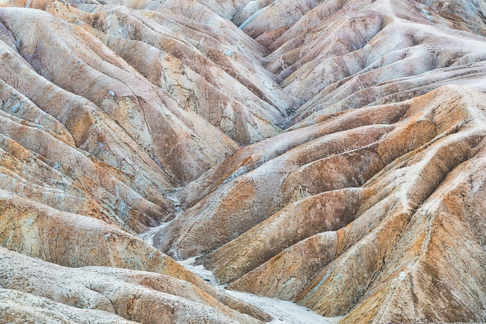
The image above was shot just after we were done capturing the setting moon. Generally referred to as the Badland Formations, this is an area of Zabriskie Point that has always caught my attention. Photographically I am drawn to the abstract nature of these formations, especially with the soft lighting present before sunrise, as was the occasion when I composed this photograph.

The next area I like visiting is Badwater Basin, noted as the lowest point in North America, with an elevation of 282 ft (86 m) below sea level. Mount Whitney (with an elevation of 14,505 feet (4421.0 m)), the highest point in the contiguous 48 United States, is only 84.6 miles (136 km) to the north west. The panorama below shows the region's floor that consists of a small spring-fed pool of "bad water" next to the road in a closed drainage basin that retains water and allows no outflow to other external bodies of water, such as rivers or oceans; the accumulated salts of the surrounding basin make it undrinkable, thus giving it the name.

IMG_3186-Edit-Edit-Edit-700x370.jpg

Badwater Basin, January 2016

The basin is the second lowest depression in the Western Hemisphere, eclipsed only by Laguna del Carbón in Argentina at −344 feet (−105 m). Adjacent to the pool, where water is not always present at the surface, repeated freeze–thaw and evaporation cycles gradually push the thin salt crust into hexagonal honeycomb shapes. On this particular visit, since the area had recently received an unusual amount of rain, the basin floor looked flat and soaked in moisture as seen above, but the image below from a 2011 shoot shows the salt crust pushed up into the hexagonal honeycomb shapes.

MG_2602-Edit-700x467.jpg

Badwater Basin, November 2011

A short drive north of this area is the turnoff to a loop road named Artists Drive, which rises up to the top of an alluvial fan fed by a deep canyon cut into the Black Mountains. Artist's Palette is an area on the face of the Black Mountains noted for a variety of rock colors. These colors are caused by the oxidation of different metals (iron compounds produce red, pink and yellow, decomposition of tuff-derived mica produces green, and manganese produces purple).

Called the Artist Drive Formation, the rock unit provides evidence for one of the Death Valley area's most violently explosive volcanic periods. The Miocene-aged formation is made up of cemented gravel, playa deposits, and volcanic debris, perhaps 5,000 feet (1500 m) thick. Chemical weathering and hydrothermal alteration cause the oxidation and other chemical reactions that produce the variety of colors displayed in the Artist Drive Formation. We did not get an opportunity to shoot the Artist's Palette during this visit, but have chosen to include the image below from a photo shoot from a couple of years ago.

IMG_1384-Edit-700x467.jpg

Artists Palette, February 2014

The average annual precipitation in Death Valley is 2.36 inches (60 mm), while the Furnace Creek Ranch area, where we stayed, averaged 1.58 in (40 mm).The wettest month on record is January 1995 when 2.59 inches (66 mm) fell on Death Valley. The wettest period on record was mid-2004 to mid-2005, in which nearly 6 inches (150 mm) of rain fell in total, leading to ephemeral lakes in the valley and the region and tremendous wildflower blooms.Snow with accumulation has only been recorded in January 1922, while scattered flakes have been recorded on other occasions.

Considering this very low annual precipitation I was pleasantly surprised a couple of years ago to discover pools of standing water in is an area named Cottonball Basin, located about 4 to 8 miles north of Furnace Creek. This is not an area easy to find as it is quite difficult to see these pools of water from the road. The water is fed from underground springs and evaporates very quickly, making it difficult at times to find, although it provides a beautiful reflective surface for any clouds in the sky at sunrise, sunset or even midday. After we checked into the hotel in Furnace Creek on our initial arrival, we drove north along Highway 190 about 45 minutes before sundown. I thought I saw water in an area about 6 miles out of Furnace Creek and took the chance that we could find it and headed out to set up and shoot the sunset, hoping to have clouds reflected in the water we may find. The image below is from that shoot looking southward into the Valley.

IMG_3158-Edit-700x467.jpg

Cottonball Basin, January 2016

The next day we decided to search the area with plenty of time before the sunset, and spent a great deal of time and effort looking for an ideal spot that would provide us with a larger pool of water. We walked many a mile and ended up finding another area, and again was fortunate to have clouds in the sky to create interesting and colorful reflections in an area renowned for very low rainfall and famous for its heat and sand dunes. Here is a shot of the four of us during the afternoon's search.

IMG_3381-Edit-Edit-700x467.jpg

Cottonball Basin, 2016

From right to left ~ Michael Heathman, Eric Emerson, Kim Porter, David Grenier

IMG_3294-Edit-Edit-2-700x467.jpg

Cottonball Basin, January 2016

The image above, of the sunset on our second night, is looking north with the Amargosa Range on the right hand side of the Valley, and a thunderstorm occurring to the left of the image in about the direction of the Mesquite Flat Sand Dunes area. As the sun went down the color of these clouds took on a bright yellow/orange hue but also diminished in size and volume, which made me select this shot to include in my blog.

Although our recent trip did not allow us to visit this area, Rhyolite is a ghost town in Nye County, in the U.S. state of Nevada, well worth visiting, especially at sunset. It is in the Bullfrog Hills, about 120 miles (190 km) northwest of Las Vegas, near the eastern edge of Death Valley. The town began in early 1905 as one of several mining camps that sprang up after a prospecting discovery in the surrounding hills. During an ensuing gold rush, thousands of gold-seekers, developers, miners and service providers flocked to the Bullfrog Mining District. Many settled in Rhyolite, which lay in a sheltered desert basin near the region's biggest producer, the Montgomery Shoshone Mine.

IMG_9489-Edit-Edit-700x467.jpg

Rhyolite Cook Bank Building remains, November 2013

Industrialist Charles M. Schwab bought the Montgomery Shoshone Mine in 1906 and invested heavily in infrastructure, including piped water, electric lines and railroad transportation, that served the town as well as the mine. By 1907, Rhyolite had electric lights, water mains, telephones, newspapers, a hospital, a school, an opera house, and a stock exchange. Published estimates of the town's peak population vary widely, but scholarly sources generally place it in a range between 3,500 and 5,000 in 1907–08.

Ryholite-Star-Trails-11-13-2013-Edit-600x900.jpg

Star Trails, Rhyolite Cook Bank Building, November 2013

Rhyolite declined almost as rapidly as it rose. After the richest ore was exhausted, production fell. The 1906 San Francisco earthquake and the financial panic of 1907 made it more difficult to raise development capital. In 1908, investors in the Montgomery Shoshone Mine, concerned that it was overvalued, ordered an independent study. When the study's findings proved unfavorable, the company's stock value crashed, further restricting funding. By the end of 1910, the mine was operating at a loss, and it closed in 1911. By this time, many out-of-work miners had moved elsewhere, and Rhyolite's population dropped well below 1,000. By 1920, it was close to zero.

Last, but not least on my list of favorite places are the sand dunes in the Park, while famous, are not nearly as widespread as their fame or the dryness of the area may suggest. The Mesquite Flat Sand Dunes field is the most easily accessible from the paved road just east of Stovepipe Wells in the north-central part of the valley and is primarily made of quartz sand. Another dune field is just 10 miles (16 km) to the north but is instead mostly composed of travertine sand. The highest dunes in the park, and some of the highest in North America, are located in the Eureka Valley about 50 miles (80 km) to the north of Stovepipe Wells, while the Panamint Valley dunes and the Saline Valley dunes are located west and northwest of the town, respectively. Prevailing winds in the winter come from the north, and prevailing winds in the summer come from the south. Thus the overall position of the dune fields remains more or less fixed.

During this particular trip we visited Mesquite Flat Sand Dunes three times, albeit it the first time for a sunrise was very brief, where we encountered heavy cloud cover rendering the color on the dunes flat and monotone. Breakfast in a warm restaurant was calling and we responded instead! The second time out we visited Hell's Gate hoping to shoot a sunset, which we did not think was going to occur as we hoped, so we decided to visit the dunes area again more or less as a scouting exercise for the sunrise the next morning, our last opportunity to shoot the dunes.

IMG_3400-Edit-700x467.jpg

Mesquite Flat Sand Dunes, January 2016

Truth be told, I was on the way out of the dunes area with another photographer because the light was again monotone and flat, when all of a sudden there was an opening in the sky that suddenly started to get some color on the eastern horizon. I know from experience that weather can change quickly and patience sometimes pays off. When the conditions started to change rapidly I knew we were out of position to shoot with the dunes in the foreground, so I managed to scramble around and find the composition above and catch the color, a small sand dune and desert bush.

IMG_3419-Edit-2-700x467.jpg

Mesquite Flat Sand Dunes, January 2016

Just when the sunset towards the east began to loose its color, my attention was brought to the sky towards the west, where the sun had gone down and the sky blew up with color that I had never seen in Mesquite Flats Sand Dunes previously. Again, after a mad scramble I was able to capture the image above, which I consider a good consolation for being so far out of position! This evening's shoot gave me an idea of what to expect in this area, one I had not been to previously. The main parking lot that accommodates visitors to the dunes, while providing great access to the highest dunes in the area, omnipresent footprint unfortunately spoil most potential compositions, essentially ruining the area for photographers. It reminds me of my days as a surfer, where one was always looking to find places that weren't crowded, where surfing beautiful waves with a couple of friends was the ideal scenario.

This particular spot, a good distance away from the main parking lot, provided access to medium size dunes and less footprints, albeit more than I would have liked. Dawn's first light is a spectacular time to be photographing on the dunes, with the amazing windswept patterns in the sand being lit up by the low light providing an overwhelming selection of compositions that are simply delightful to witness and photograph. The following images are from the next morning's shoot, where we arrived just after 6:30 am and walked out into the dunes under the bright light of a setting full moon, with the sunrise set to come over the horizon at about 7:10 am. Here are three more images, shown below, from our morning shoot on our last day in Death Valley. The sensual shapes, lines, textures, shadows and light are a photographers dream, and simply stunning to experience and witness in person.

IMG_3439-Edit-3-700x469.jpg

'One Small Step...' ~ Mesquite Flat Sand Dunes, January 2016

IMG_3461-700x467.jpg

Mesquite Flat Sand Dunes, January 2016

IMG_3470-700x467.jpg

Mesquite Flat Sand Dunes, January 2016

So there you have it, a summary of my favorite places to visit in the magnificent Death Valley National Park, with some history and points of interest (thanks to Wikipedia and the National Park Service), as well as images that I hope will peak your interest to visit someday. I also need to tell you that I am only scratching the surface of things to see and do here, and a great place to begin when you get to the Park is stop by the Furnace Creek Visitor Center and talk to one of the Park Rangers, who are extremely friendly and helpful to all visitors. A 20 minute park film is shown throughout the day. During the winter season, November to April, rangers present a wide variety of walks, talks, and slide presentations about Death Valley's cultural and natural history. Additional programs may be presented at other times. Inquire at the visitor center for current programs. Death Valley is truly a unique experience and the variety of places to visit could keep you engaged and busy for days.

Enjoy!

2015 Top Twelve Photographs of the Year

“Twelve significant photographs in any one year is a good crop.”~ Ansel Adams

It is my pleasure, albeit a lot of work, to continue an annual tradition that I began in 2013, where I gather and publish my top Twelve Photographs of the year. This tradition stems from the quote above attributed to Ansel Adams, one of the most recognized names of photographers in the modern era, particularly famous for his magnificent black and white photographs of Yosemite National Park. His quote is a conscious thought that guides me during most of my photoshoots, where I remind myself that realistically I am looking for just one or two images that will be significant and capture the essence of what I am looking at in the field.

When you shoot a few thousand images as I do on an annual basis it is difficult to cull this all down to 'twelve significant photographs' so, as in previous years, I determine the Top Twelve, and the order of the selections, by looking back at my Facebook page and noting how many Likes/Comments I received when they were originally posted on my wall. I am fully aware that this is far from scientific or could be argued that it is downright arbitrary, but that is the method I have used and will continue to do so again this year.

I was fortunate to have traveled and created opportunities to shoot in a wide variety of places in 2015. From my favorite venues such as Yosemite National Park, Mono Lake, Bodie Historical State Park, Mt. Tamalpais in Marine County, and the Central Coast in California, I also made it back to the country of my birth Sri Lanka again, and spent a month in my 'second home', Australia.  A first time for me this year I had an opportunity to visit Page, Arizona and the amazingly colorful slot canyons of Lower Antelope Canyon and Secret Canyon. As a photographer, I consider myself lucky to live in El Dorado Hills, just 30 miles northeast of Sacramento, as it allows me to get to some of the most beautiful National and State Parks within a four to five hour drive from my home.

So again this year I will count them down starting with Number 12, give you the Facebook vote count, say something about each image, and provide some basic EXIF data.

#12 - (120 votes) 'Where Angels Tread' ~ California has been in a significant drought for the last four years when an unexpected spring storm went through Yosemite, dumping significant snow at higher elevations. I drove into the Park and went down to a favorite spot on Southside Drive to capture these beautiful reflections of the Three Brothers in the Merced River.

IMG_4347-Edit-700x467.jpg

May 7, 2015, Three Brothers, Yosemite National Park, California, exposure 1/5 sec @ f/11; 16-35 mm lens at 19 mm; ISO 100

#11 - (122) 'Hot Summer Nights' ~ we had been experiencing triple digit heat for a couple of days in a row, with the temperature only dropping down into the 90's at night when I decided to go shoot the sunset at this 'new' location, about 20 minute drive from my home. I have a love for oak trees, especially located on top of the rolling hills in this area that silhouette against the sky, which was filled by this typical Northern California summer evening's clouds that get lit up by a sunset. I used a higher ISO setting in order to freeze the moving grass stems due to the presence of a stiff breeze this particular evening.

IMG_6843-700x467.jpg

June 26, 2015, Scott Boulevard, Rancho Murrieta, California, exposure 1/10 @ f/11, 16-35 mm lens @ 16 mm, ISO 800

#10 - (123) 'Turbulence' ~ there is something about the intensity of tropical sunsets that sets them apart, and this one shot in a town called Koggala, on the south western side of the island of Sri Lanka was no exception. I decided to go down to this beach area, a short walking distance from the hotel we were staying in despite the prospects for a great sunset looking fairly slim. However, I knew from experience, even though the sky was laden with heavy clouds as long as an opening existed above the horizon the chances were good that the sky could develop into a good sunset. I was so glad to have been right on this particular evening!

IMG_8838-Edit-700x467.jpg

August 31, 2015, Koggala, Sri Lanka, exposure 0.6 secs @ f/14, 24-105 mm lens @ 35 mm, ISO 200

#9 - (125) 'Double Trouble' ~ we had an amazing storm move through the area this particular evening, bringing with it rain, lightning, thunder and gnarly looking clouds. I went to shoot from a favorite location of mine locally, about 10 minutes drive from my home, and while I was composing and shooting the sunset scene, intuitively I turned around 180 degrees behind me to find this beautiful double rainbow and magnificent sky. The title of this image is a dedication it to the late Stevie Ray Vaughn and his band Double Trouble, that were recently inducted into the Rock and Roll Hall of Fame!

IMG_6503_HDR-Edit-2-Edit-700x468.jpg

June, 5, 2015, Scott Boulevard, El Dorado Hills, California, exposure 1/3 sec @ f 11, 16-35 mm lens @ 16 mm, ISO 125

#8 - (127) 'El Capitan's Evening Light' ~ shot on the evening of my birthday, April 7, this magnificent granite monolith, named "El Capitan" by the Mariposa Battalion when it explored the valley in 1851, meaning "the captain", "the chief", was taken to be a loose Spanish translation of the local Native American name for the cliff that extends about 3,000 feet (900 m) from base to summit along its tallest face. I used a polarizing filter on this shot, which allows the beauty of the reflection in the Merced river to shine through in detail, and interestingly the only vertical image in this collection!

IMG_3939-Edit-600x900.jpg

April 7, 2015, El Capitan, Yosemite National Park, California, exposure 1/5 sec @ f/11, 16-35 mm at 16 mm, ISO 100

#7 - (133) 'Synchronicity' ~ spent Christmas afternoon with my three adult children and their extended family enjoying great food and conversations! The backyard of the home we had dinner in was a magnificent wide wet sand beach, which acted like a gigantic reflective mirror that perfectly duplicated these early sunset clouds. Pajaro Dunes Beach is in Watsonville, and the width of the beach was in part due to a tidal range of just over 7.5 feet on the day caused by the full moon, the first on Christmas Day in 38 years!

IMG_2948-Edit-700x467.jpg

December 25, 2015, Pajaro Dunes Beach, Watsonville, California, exposure 1/13 sec @ f/11, 16-35 mm leans @ 21 mm, ISO 125

#6 - (142) 'Awakening' ~ I had not been to the Hawaiian Island in a few years, and I had never visited the island of Maui. This was a sunrise at Koki Beach, just south of Hana on the east coast of Maui. The large red cinder hill to the left is Ka Iwi o Pele, 'the Bones of Pele', that is the remnant of a volcanic vent, and according to a Hawaiian legend, the Goddess Pele was killed near this place by her older sister, and her bones were piled up to make this hill. Her spirit fled southeast from this point to the Big Island, where is is said to still reside today. In more recent times, this hill now belongs to Oprah, as part of a 105 acre parcel that she bought from Hana Ranch in 2002.

IMG_5053-Edit-Edit-Edit-700x467.jpg

May 20, 2015, Koki Beach, Maui, Hawaii, exposure 0.3 sec @ f/22, 16-35 mm lens at 16 mm, ISO 125

#5 - (153) 'Tropical Playground' ~ this was the first image of a sunset trilogy captured at Koggala, south west Sri Lanka, shot on the beach in front of our hotel. The second image of the trilogy is shown in image #10 above. I have never seen clouds like this develop into these awesome formations, highlighted by magical light that placed emphasis in just the right places. It is beyond good fortune to travel half way round the world to witness and photograph the unrivaled beauty of Mother Nature at her finest!

IMG_8763-Edit-Edit-700x467.jpg

August 31, 2015, Koggala, Sri Lanka, exposure 10.6 secs @ f/22, 24-105 mm lens at 24 mm, ISO 125

#4 - (154) 'Kīlauea Sunrise' ~ we spent the first two nights of our Hawaii photoshoot on the Big Island, and this was a 5:00 am shot of the glow generated by the lava lake in Kīlauea, a currently active volcano, and the most active of the five volcanoes that together form the island of Hawaiʻi, and, perhaps, the most active volcano on earth. There is something very primal and attractive for us humans to see molten lava, which builds and yet destroys, and is completely uncontrollable by mankind.

IMG_4407_HDR-700x466.jpg

Kilauea, Big Island, Hawaii, this is an HDR blend of 3 images, exposure @ f/4, 16-35 mm lens @ 16 mm, ISO 1,600

#3 - (195) 'Full Moon Rising' ~ shot this from my backyard in El Dorado Hills, in what turned out to be the final Supermoon of 2015. If you missed this night's show, you will have to wait until October 2016 to see another one. It was the sixth Supermoon of the year and came just a month after another Supermoon, which also happened to be a total lunar eclipse. This night's full moon meant the orb not only appeared brighter but also larger than normal – about 14 percent bigger than a normal moon. In 2016 there will be 3 Supermoon's, beginning in October, as mentioned above, with November and December's moons also being classified as Super.

IMG_0599-Edit-Edit-Edit-Edit-700x467.jpg

October 26, 2015, El Dorado Hills, California, exposure 0.8 secs @ f/8, 400 mm lens plus 1.4 converter @ 560 mm, ISO 100

#2 - (233) 'Morning Has Broken' ~ one last image shot in 2015, from my Yosemite shoot at the end of December. Found myself at the Gates of the Valley AKA Valley View, with morning light hitting El Capitan just right to create this beautiful reflection in a fairly still and frozen in patches, Merced River. This, along with Tunnel View are two of the classic locations for photographer's in Yosemite Valley, and this particular spot provides a beautiful reflective opportunity of El Capitan and the Cathedral Rocks on the right, that include Bridalveil Falls, which was somewhat frozen during this particular winter's day.

IMG_3042-Edit-Edit-Edit-Edit-700x467.jpg

December 27, 2015, Valley View, Yosemite National Park, California, exposure 0.3 secs @ f/11, 16-35 mm lens @ 16 mm, ISO 100

#1 - (300) 'A Milky Way' ~ one of my favorite images from a photoshoot at Mt Tamalpais on May 2, with my daughter Michelle Grenier, an accomplished photographer in her own right (www.instagram.com/michiesharine/?hl=en) as my guide. We were very fortunate to have a magnificent layer of coastal fog move in to make this simply a magical sight and photo opportunity! I decided to use a high ISO setting because of the presence of a stiff breeze and I wanted to make sure that the grass and trees in this shot weren't blurred by the wind in the resulting photograph.

IMG_4265-Edit-2-700x467.jpg

May 2, 2015, Mt Tamalpais, Marine Country, California, exposure 1/8 sec @ f/11, 24-105 mm lens at 50 mm, ISO 1,200

There you have it, my third annual Top 12 Photographs for the 2015 year. A few observations in closing - 1. Eight of the images voted on were shot in California locations, 2. two were from Sri Lanka, and 3. the remaining two were from my Hawaiian Islands shoot. It is interesting for me to compile these images every year and realize the wonderful accomplishment I was privileged to be allowed to complete by traveling to these beautiful locations, as well as what excellent tastes and insights that the followers of my Facebook page have displayed, and how much these people help in my selection process at the end of each year. So a big thank you to all these people for taking the time to do so - greatly appreciated!

In conclusion, and as always, I owe a great deal of gratitude to the many, many people who support my photography by purchasing my images in print form, as well as the hundreds of Likes and Comments that so many people take the time to stop by and leave on my Facebook page at  http://facebook.com/djgrenier , and last not least, the photographers and friends of mine that I travel and live with during these photographic journeys through out the year - again, my deepest thanks!

Looking forward to 2016 and wishing everybody a Wonderful New Year!

A Short History of Grenier Road, Colombo, October 2015

Some of my family and friends are aware that I have been working on republishing my father's book of short stories entitled 'Isle of Eden'. To that end I have been working with a Mr. Sam Perera of Perera-Hussein Publishing (www.pererahussein.com) in Colombo, Sri Lanka, who has been a friend and supporter of this project for some time now, and did a great job proof reading the final manuscript for me. I informed Sam that I would be visiting Sri Lanka in August and would like to meet and have lunch with him when I got to Colombo. He accepted my invitation and wrote back 'You probably know there is a street in Colombo that carries your last name. Probably an illustrious ancestor.' I did not know, nor was my family aware of the existence of Grenier Road when we lived in Colombo in the early '50s, so I was delighted to locate and visit the street that carries my family name with my travel companions and cousins Michael and Sharlene Roosmale-Cocq on September 3, 2015, where the photograph below was taken.

The sign is written in Sinhalese, Tamil and English, in descending order. As an aside, I look back in amazement that several years of my schooling outside of Colombo was done completely in the Sinhala language, which I spoke fluently and wrote proficiently/daily in the beautiful characters of the Sinhalese alphabet, as seen below.

IMG_8921-Edit

Coincidentally I also came to realize that I was born at De Soysa Maternity Hospital, less than a quarter mile from this sign, which helped prompt me to ask the obvious question 'who was the street named after?', and the follow up to that, 'was this an illustrious ancestor?'. While in Colombo during the last days of our visit I did some research via Google to no avail. Michael picked up the research when he got back to Australia and discovered the following information - Grenier Road was named in 1886 after the first secretary of the Colombo Municipal Council - Sir Samuel Grenier.

I was excited, to say the least, when I received this information and immediately went to a comprehensive copy of my family genealogy to discover that, Sir Samuel Grenier was my great, great, grandfather’s elder brother!

A brief synopsis of the illustrious Samuel Grenier's life - Sir John Samuel Charles Grenier, born 16 June 1840 in Jaffna, Northern Province, Ceylon; died 31 October 1892 in Colombo, Western Province, Ceylon.

Samuel had high intellectual gifts and was appointed Headmaster of the Central School when only 20 years of age. On traveling to Colombo he gained a job as sub-editor of a newspaper 'The Examiner', while continuing his legal studies until in 1864 when he passed the Advocate examinations. He next became the first Secretary of the Colombo Municipal Council, age 24.

In 1876 he was offered and accepted an appointment to the Supreme Court Bench. He eventually went on to be appointed Attorney General of Ceylon, receiving his Knighthood in 1891 from the Queen of England, Her Royal Majesty Queen Victoria, a year before his passing,

Gives new meaning to the phrase 'its a small world'.................

Negombo, Sri Lanka, August, 2015

I spent the first few days of my journey back to Sri Lanka in one of my favorite towns in this country, Negombo, just north of Colombo, the country's capital. It is home to the country's main airport, Bandaranaike International, named after former Prime Minister S.W.R.D. Bandaranaike. He was the fourth Prime Minister of Ceylon (later Sri Lanka), serving as Prime Minister from 1956 until his assassination by a Buddhist robe wearer in 1959. Bandaranaike's widow Sirima Ratwatte Dias Bandaranaike, went on to become the world's first female Prime Minister, elected to office in July 1960. But I digress, as I originally began to describe my familial connection to Negombo, which goes back to my grandfather, on my mother's side, who was born in Negombo, married my grandmother Ruth Modder in St. Stephen's Church in Negombo. My mother, Sheila (Modder) Grenier, and her 5 siblings were all born in Negombo, and she married my father, Ronnie Grenier, in the same St. Stephen's Church. I lived in Negombo from the age of 4 until I left at the age of 10 to live in a town named Badulla.

My earliest memories of my childhood goes back to Negombo, where I first began a life-long affinity for the ocean and became familiar with the catamaran, the vessel used by the local fisherman to take them a few miles out to sea to catch their fish that they sell at the local fish markets to eek out a meager living. These vessels were originally built by hollowing out a tree trunk, but the progress of man has brought us into a new era and the boats used now are all fiberglass, making them much more durable and safer than their dugout predecessors.

IMG_7363-Edit-Edit-700x467.jpg

The image above shows a typical morning with fishing boats returning home after being out all night. On this particular morning the seas were rough with a strong onshore wind blowing at about 20 knots, making it a tough slog navigating these vessels through the uneven swells.

IMG_7358-Edit-Edit-Edit-Edit-700x467.jpg

I found this fishing boat, a relic of my past as a child growing up in Negombo, lying along the beach just north of where I stayed. It was a vessel used many years ago by Sinhala fisherman for carrying out a massive net cast out in the ocean and then dragged into the shore trapping all and sundry in its wake. I remember it being 'huge' as a child and but found it much smaller in real life - funny how that works!

IMG_7402-Edit-Edit-Edit-700x467.jpg

It takes quite some skill and experience to bring these catamarans into the shore, including getting past and navigating through the shore break, as show above.

IMG_7378-Edit-Edit-Edit-700x467.jpg

My eye caught the beautiful morning's low light as these catamarans were fishing just outside the fishing village of Palangathure, Negombo.

IMG_7406-Edit-Edit-Edit-2-700x477.jpg

'Homeward Bound' ~ caught this catamaran coming into shore, into a small fishing village named Palangathure, Negombo. It is a Muslim community, as can be evidenced by the golden domes of their mosque in the background, and that's why they were out fishing on a Sunday morning. They will unload the fish they caught and sell it immediately to the highest bidder in the village. It's a hard life these sea faring men live as they have done for many, many years.

I will always have a special place in my heart for Negombo, and its fisherman, and the beautiful catamarans they utilize to go out to sea and make their catch, the very basis of their existence and livelyhood!

Enjoy!